In the complex landscape of construction and infrastructure development, understanding what lies beneath the surface is as crucial to a project as the visible components. The subsurface is often a labyrinth of utility lines, pipes, and structural foundations, requiring meticulous investigation to prevent costly errors, delays, and, most importantly, to ensure safety. Accurate reporting and mapping in projects requiring subsurface investigations play a pivotal role in this context, where precision can make the difference between success and disaster. Smartscan Locators, a leader in this essential field, employs state-of-the-art methods to deliver unrivaled accuracy and reliability.
Why Accuracy Matters in Subsurface Investigations
The importance of accurate subsurface investigations cannot be overstated. Inaccurate data or mapping can lead to a multitude of problems – from minor inconveniences to catastrophic failures. Strikes on underground utilities can result in significant service disruptions, severe injuries, or even fatalities. Moreover, such mistakes can lead to hefty fines, legal complications, and reputational damage for the entities involved. Therefore, precision in reporting and mapping is not just a technical requirement but a critical safety measure.
Smartscan Locators: Ensuring Precision Through Advanced Methods
Smartscan Locators stands at the forefront of subsurface investigation by integrating advanced technology and proven methodologies to ensure the highest accuracy in underground utility reporting and mapping. Here’s a glimpse into some of the cutting-edge methods they employ:
Ground Penetrating Radar (GPR): GPR technology is instrumental in detecting non-conductive materials and utilities, including plastic pipes and conduits, fibreglass structures, and voids within a variety of media. This non-intrusive method provides a clear picture of the subsurface environment, significantly reducing the risk of damaging unseen utilities.
Electromagnetic Locators (EML): For detecting conductive services like metal pipes and electrical cables, Smartscan Locators utilises EML technology. This method allows for precise location and depth determination, facilitating accurate mapping and safe excavation around these utilities.
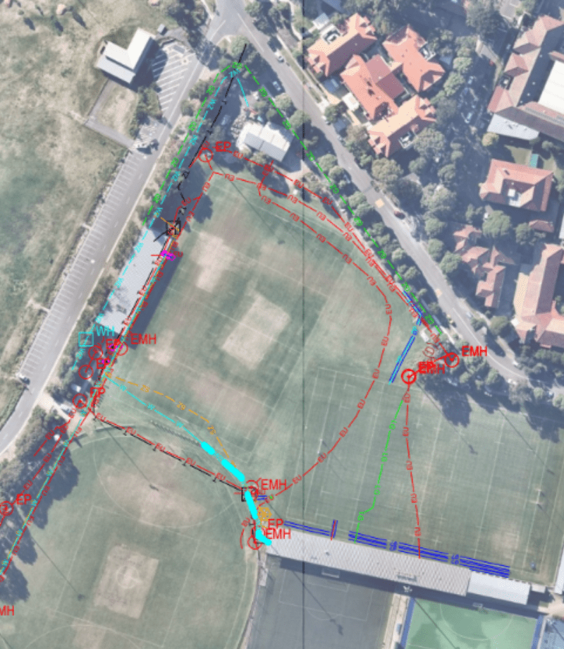
Utility Mapping and Reporting: Combining the data gathered from the aforementioned technologies, Smartscan Locators can produce comprehensive utility maps and reports. As part of the process, utilities will first be located and marked on site and photos recorded. This is then compiled in a Detailed Utility report which contains depth of Utility, diameter of pipe/s, location measured off known reference point, path of Utility, material of pipe/s and photos. This can be tailored as necessary to fit specific project requirements.These documents provide a detailed visualisation of the subsurface infrastructure, ensuring that project planners, engineers, and construction teams have accurate and actionable information to guide their decisions.
The significance of accurate reporting and mapping in subsurface investigations cannot be understated. It is the foundation upon which safe, efficient, and successful construction projects are built. Smartscan Locators, with its arsenal of advanced technologies and methodologies, and together with their wealth of experience in various projects throughout the greater Sydney region, exemplifies the highest standards in underground utility detection and mapping. By prioritising precision and safety, Smartscan not only mitigates the risks associated with subsurface utilities but also paves the way for the seamless execution of construction projects.
As the industry continues to evolve, the reliance on such sophisticated investigative methods will undoubtedly grow, underscoring the ever-increasing importance of accurate subsurface reporting and mapping. If you require underground utility locating, reporting and mapping services, Smartscan offer a vast range of options to suit projects of all different sizes and statures, from small backyards, all the way to Tier 1 projects. Contact our professional team today for a consultation of your requirements.

